Shasta Alpine Hut Map
illustration
commission
alpine
hut
digital
montology
cartography
map
LBET
VizThink
Logo and Map Commission
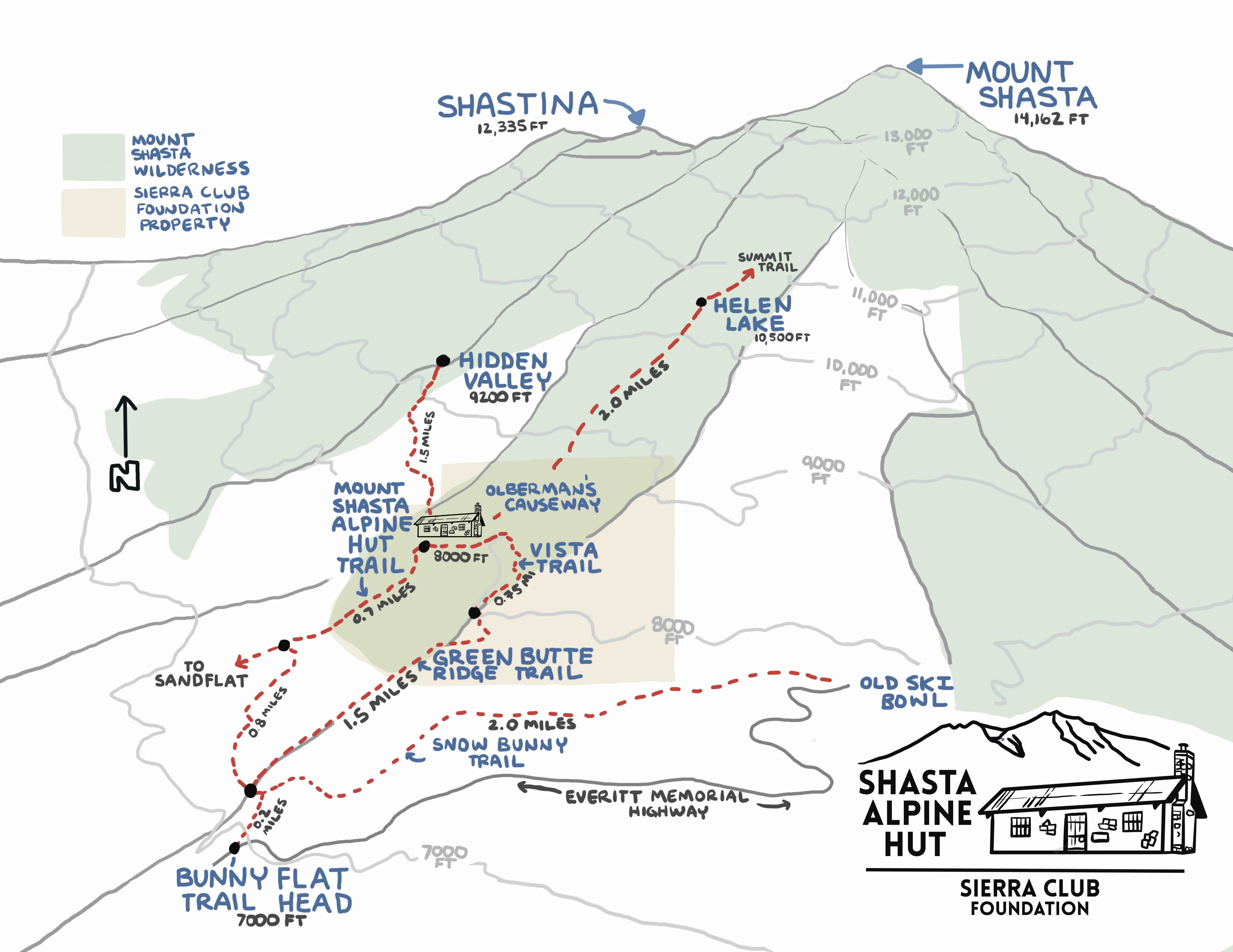
This is my second season working up at the Shasta Alpine Hut. I was commissioned by the Sierra Club Foundation to make a map of the the major trails through their property and the adjacent land. It was a fun project to figure out how to make a map with The Shasta Alpine Hut (Formally Horse Camp Hut) as the central hub of trails on this side of the mountain. After I finished the map, we had copies up at the hut. Throughout the season I talked to a number of tourists who used my map to navigate during their hike. Success!